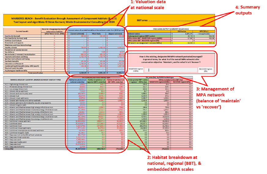
BEACH4MARBEFES represents the operationalising of a published methodology for estimating the spatial value of the marine environment at sub-national scales. It integrates recent developments in natural capital accounting with developments in the spatial mapping of marine habitats, and is informed by an understanding of the links between habitats and ecosystem services.
It enables economic values to be estimated at sub-national scales, that is, those scales at which management interventions, such as the designation of MPAs, are often applied.
The development of the BEACH4MARBEFES tool facilitates the transfer of national scale societal benefit to the smaller scales of component habitats and sub-regions across the MARBEFES project’s case-study sites (Broad Belt Transects, BBTs).
In summary, the methodology underpinning the tool realises the transfer of values by:
(1) disaggregating national-scale benefit valuations according to the relative abundance of each constituent EUNIS (level 3) habitat type, and the intrinsic value of each habitat type for each societal benefit stream as assessed by Potts et al. (2014) allied with a straightforward conversion from semi-quantitative ordinal data to quantitative, ratio-scale data;
(2) subsequently re-aggregating the derived ‘transfer’ values for each specific habitat/benefit combination on the basis of the extent of each constituent EUNIS (level 3) habitat type present within discrete target areas across a range of possible scales within a given regional/local marine area; before
(3) producing derived annualised valuations for societal benefits at the new (target) scale (e.g. BBT).
Category:
Tool Types:
Target User:
Locations Tested:
Level of uncertainty:
Version:
Rights:
Publication:
Difficulty:
Skill Required:
Authors:
Tool Contributors:
Project general coordinator:
Project Scientific manager:
Project Manager: